A property near the Port of Los Angeles or Port of Long Beach does not automatically require coverage under the Region 4 Commercial, Industrial, and Institutional Stormwater Permit. The first geographic question is whether the property is within the designated Dominguez Channel / Los Angeles and Long Beach Inner Harbor Watershed. Site drainage and storm-drain connections may also require review when the mapped location or discharge route is unclear.
After the geographic assessment, the facility must still meet the Order’s CII Site, private-ownership, acreage, existing-permit-status, and other applicability requirements.
Order R4-2026-0226 / NPDES Permit CAS004005 became effective on October 31, 2026, and is listed as active by the Los Angeles Regional Water Quality Control Board. 1

TL;DR
- The Region 4 CII Permit applies to qualifying sites in the Dominguez Channel / Los Angeles and Long Beach Inner Harbor Watershed, not every property in a harbor-area city.
- The Los Angeles and Long Beach Inner Harbor is part of the adopted watershed framework. It is not regulated under a separate Inner Harbor CII permit.
- Property location should be checked using Attachment B watershed maps, Attachment C storm-drain-system maps where necessary, and available site-drainage information.
- Waterfront proximity, a port-area address, city boundaries, and ZIP codes do not establish coverage.
- A site within the watershed must still meet the Permit’s facility, ownership, acreage, existing-permit, and other applicability requirements.
Does the CII permit apply to properties draining to the Los Angeles or Long Beach Inner Harbor?
Potentially, but only when both the geographic and facility-specific requirements are satisfied.
The adopted Order regulates qualifying stormwater and authorized non-stormwater discharges from certain privately owned commercial, industrial, and institutional sites within:
- The Dominguez Channel / Los Angeles and Long Beach Inner Harbor Watershed; and
- The Los Cerritos Channel / Alamitos Bay Watershed. 2
The Order includes discharges from CII Sites that reach receiving waters directly or through municipal separate storm sewer systems or private conveyance systems. A property therefore does not have to be directly on the waterfront. However, a drainage connection alone does not replace the need to confirm the property’s position within the adopted watershed framework.
How does the Inner Harbor fit into the adopted CII permit area?
The Los Angeles and Long Beach Inner Harbor is a receiving-water component within the larger Dominguez Channel / Los Angeles and Long Beach Inner Harbor Watershed identified in the Order. It is not a standalone watershed or the subject of a separate Los Angeles Harbor or Long Beach Harbor CII permit.
The following terms describe different parts of the regulatory and drainage framework:
- A watershed is the land area draining toward a receiving-water system.
- A receiving water is the surface water that receives the discharge.
- An MS4 is a public stormwater conveyance system that can carry runoff toward receiving waters.
- A private conveyance may also carry runoff from a site to receiving waters.
- A CII Site is the property unit evaluated under the Order’s definitions and applicability provisions. It is not necessarily identical to one Assessor Parcel Number.
EPA Region 9 used its residual-designation authority to designate specified stormwater discharges from privately owned CII sites in the two Los Angeles County watershed areas for NPDES permitting. The Los Angeles Regional Water Quality Control Board subsequently adopted Order R4-2026-0226 to provide the applicable permit framework. 3
Older EPA, mapping, or draft-era materials may use different harbor-area terminology. Current applicability decisions should use the watershed name and requirements in the adopted 2026 Order.
For the complete geographic scope of both watershed systems, see “Where Does the Region 4 CII Stormwater Permit Apply?”.
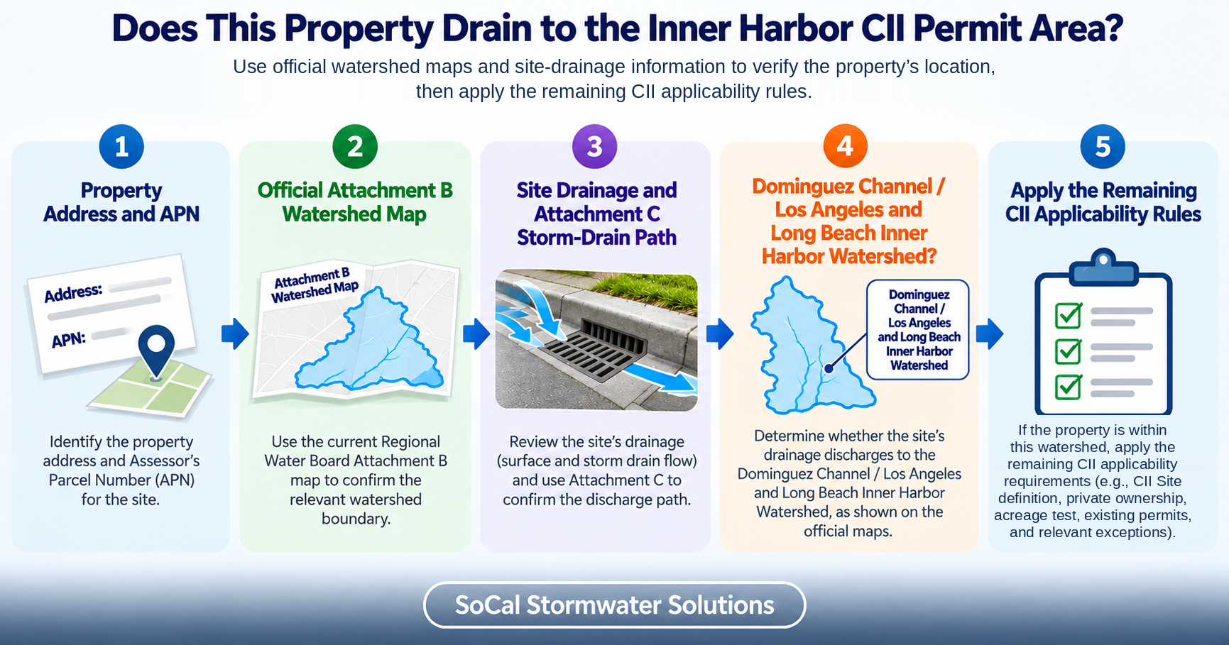
How do you verify a property’s watershed and drainage connection to the Inner Harbor?
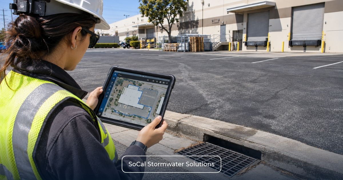
Begin with the property’s mapped location, then review its drainage pathway where needed. Neither proximity to the harbor nor an assumed storm-drain connection provides a complete determination.
A practical review follows this sequence:
- Identify the property and APNs. Confirm the address, parcel numbers, site boundaries, and relevant contiguous parcels.
- Review Attachment B. Locate the property on the adopted Permit’s watershed-management-area and hydrologic-unit maps.
- Review Attachment C where necessary. Use the storm-drain-system mapping when the parcel is near a drainage divide or the discharge route is unclear.
- Compare mapping with site drainage. Review drainage areas, slopes, catch basins, onsite pipes, channels, discharge points, and known public or private connections.
- Trace the discharge route. Determine whether the site’s runoff is conveyed toward receiving waters within the designated watershed system.
- Document unresolved conditions. Obtain additional site records, utility information, field observations, or agency clarification where the available evidence is inconclusive.
- Apply the other coverage criteria. Complete the CII Site, ownership, acreage, existing-permit, and exception analysis.
Attachment B provides watershed-management-area hydrologic-unit maps, while Attachment C provides regional storm-drain-system maps. Figure B-2 identifies the Dominguez Channel and Los Angeles/Long Beach Harbors hydrologic units, and Figure C-2 shows the corresponding storm-drain system. These figures support geographic and drainage screening but do not independently establish a property’s CII coverage status. 2
The figure captions use “Los Angeles/Long Beach Harbors,” but current regulatory references should continue to use the adopted Order’s full watershed name: Dominguez Channel / Los Angeles and Long Beach Inner Harbor Watershed.
Where the mapping and site information do not support a clear conclusion, the property should receive a technical review rather than being assigned a categorical status from its address alone.
For the complete verification methodology, see How to Determine Which Watershed Your Property Drains to.
Does being near the port or harbor mean a property is covered?
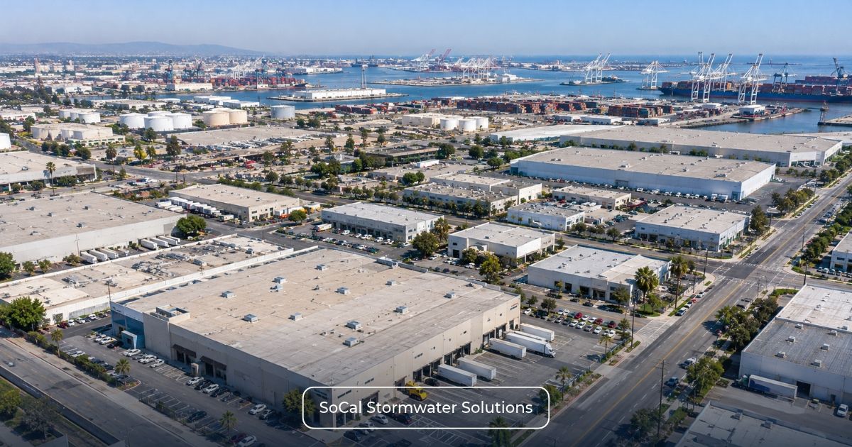
No. A harbor-area address is neither proof of coverage nor proof of exemption.
A waterfront property may have a drainage configuration that requires additional review. Conversely, an inland property may discharge through an MS4 or private conveyance toward receiving waters within the designated watershed.
Consider two facilities in the same city. One may connect to drainage infrastructure leading toward the Inner Harbor system, while the other may lie in a different hydrologic area or have an unresolved discharge route. Their shared city name and ZIP code do not produce a reliable watershed conclusion.
A harbor-area address is not proof of coverage
None of the following establishes coverage by itself:
- A Port of Los Angeles or Port of Long Beach mailing address;
- Proximity to a waterfront, harbor, channel, or port facility;
- A Wilmington, San Pedro, Carson, Long Beach, or other nearby community name;
- A ZIP code;
- Industrial or port-related zoning;
- Appearance within a general city map; or
- A description of the site as being in the “greater harbor area.”
These details may help identify the property, but the geographic conclusion must rely on the adopted watershed framework and sufficient property and drainage information.
Which properties inside the watershed may need coverage?
After confirming the geographic requirement, evaluate whether the property is a qualifying privately owned CII Site. Residential facilities are excluded, and mixed-use properties require application of the Order’s specific boundary provisions.
The applicable acreage branch then depends on whether another NPDES stormwater permit covers the qualifying CII Site.
The table summarizes the two principal acreage branches. Detailed measurements and special configurations belong in the dedicated threshold guide.
| CII permit five-acre thresholds by existing NPDES stormwater coverage | ||
| Property Status | Principal Acreage Test | Primary Review Question |
| Qualifying CII Site Not Covered by Another NPDES Stormwater Permit | Five or More Acres of Impervious Surface | How much qualifying impervious surface is within the CII Site? |
| Qualifying CII Site Covered by Another NPDES Stormwater Permit | Five or More Acres of Total Area | What is the complete CII Site, and what does the existing permit cover? |
Meeting the applicable acreage measurement does not establish coverage unless the watershed, CII Site, private-ownership, residential or mixed-use, and other permit requirements are also satisfied.
A single APN should not automatically be treated as the final CII Site boundary. Contiguous parcels, property configuration, and existing permit boundaries may require additional review.
For detailed acreage methodology, see Region 4 CII Permit 5-Acre Threshold: Does Your Property Need Coverage?.
What if the property already has another NPDES permit?
Existing NPDES stormwater coverage does not automatically exempt an entire CII Site. The facility must compare its qualifying site boundary with the area addressed by the existing permit and apply the relevant provisions of Order R4-2026-0226.
Sections 3.1.3.1 through 3.1.3.3 distinguish three situations:
- No Exposure Certification (NEC): Qualifying facilities must obtain CII coverage for acreage covered by the NEC.
- Notice of Non-Applicability (NONA): Qualifying facilities must obtain CII coverage for acreage not covered by the NONA.
- Partial NPDES stormwater coverage: Where another NPDES stormwater permit covers only part of a qualifying facility, CII coverage is required for the remaining portion.
These provisions operate within the Order’s broader watershed, CII Site, ownership, and applicable five-acre requirements. Under Section 3.1.4, facilities with individual NPDES permits containing requirements at least as stringent as the CII Permit are not required to obtain separate coverage under this General Permit.
For additional guidance, see Existing NPDES or IGP Coverage? When the Region 4 CII Permit Still Applies, How the CII Permit Applies to NONA Facilities, and CII Permit Rules for Partially Covered Properties.
Our guide about the Industrial Stormwater Permitting Process provides related information about existing Industrial General Permit records and permitting procedures.
What should you gather for an Inner Harbor CII screening?
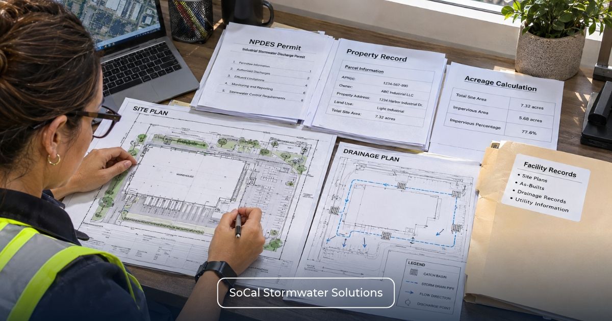
An effective screening combines official mapping with property, drainage, ownership, acreage, and permit information.
Inner Harbor CII screening information
Before requesting a screening, gather:
- Property address and APNs;
- Parcel or site map;
- Current facility drainage map, if available;
- Onsite drainage areas and flow directions;
- Catch basins, channels, pipes, and discharge points;
- Known public or private storm-drain connections;
- Facility use and land-use classification;
- Property owner and operator information;
- Residential or mixed-use components;
- Total site acreage;
- Impervious acreage;
- Existing WDID and NPDES permit information;
- Current NEC or NONA records, if applicable;
- Boundaries of partially permitted areas; and
- Information about contiguous parcels or campus operations.
For related geographic analysis, see:
- Dominguez Channel CII Stormwater Permit Guide
- Los Cerritos Channel CII Stormwater Permit Guide
- Alamitos Bay CII Stormwater Permit Guide
If the review establishes that CII coverage is required, SMARTS Permitting and Application Services may support the applicable electronic permit workflow.
Request a CII Permit Applicability Screening
Unsure whether your property falls within the Inner Harbor CII Permit area? SoCal Stormwater Solutions can review your property records, official watershed maps, site drainage, storm-drain connections, acreage, and existing permit status to help assess potential coverage requirements.
Request a CII Permit Applicability Screening to discuss the information needed for your property-specific review.
Screening is based on available property and permit information and does not guarantee a particular determination by the Los Angeles Water Board.