A property needs more than an address near the Dominguez Channel to require coverage under the Region 4 Commercial, Industrial, and Institutional Stormwater Permit. It must be within the Dominguez Channel / Los Angeles and Long Beach Inner Harbor Watershed and satisfy the Permit’s CII Site, private-ownership, acreage, existing-permit-status, and other applicability requirements.
The Los Angeles Regional Water Quality Control Board adopted Order R4-2026-0226 / General NPDES Permit CAS004005 on July 23, 2026. The Order became effective on October 31, 2026, and is listed as active in the Water Board’s permit record. 1

TL;DR
- The Permit applies to qualifying privately owned CII Sites within the Dominguez Channel / Los Angeles and Long Beach Inner Harbor Watershed—not every property in nearby cities or Los Angeles County.
- Watershed location must be verified at the property level. City boundaries, ZIP codes, zoning, and proximity to the channel are not coverage boundaries.
- A property inside the watershed must still meet the CII Site, private-ownership, acreage, and existing-permit-status requirements.
- Qualifying sites without another NPDES stormwater permit use a threshold of five or more acres of impervious surface.
- Qualifying sites covered by another NPDES stormwater permit use five or more acres of total area.
- Existing IGP, NEC, NONA, partial-coverage, and multi-parcel conditions should be resolved before enrollment.
Does the Region 4 CII permit apply in the Dominguez Channel watershed?
Yes, but only to qualifying privately owned CII Sites within the watershed boundary that satisfy the remaining applicability requirements.
Section 3.1.1 of Order R4-2026-0226 applies to stormwater runoff and authorized non-stormwater discharges from certain privately owned CII Sites, excluding residential facilities, in two watershed areas:
- The Dominguez Channel / Los Angeles and Long Beach Inner Harbor Watershed; and
- The Los Cerritos Channel / Alamitos Bay Watershed. 2
This guide addresses the first watershed. The broader classification, ownership, acreage, and permit-status framework is explained in “Who Needs Coverage Under the Region 4 CII Stormwater Permit?”.
What area does the Dominguez Channel CII permit cover?
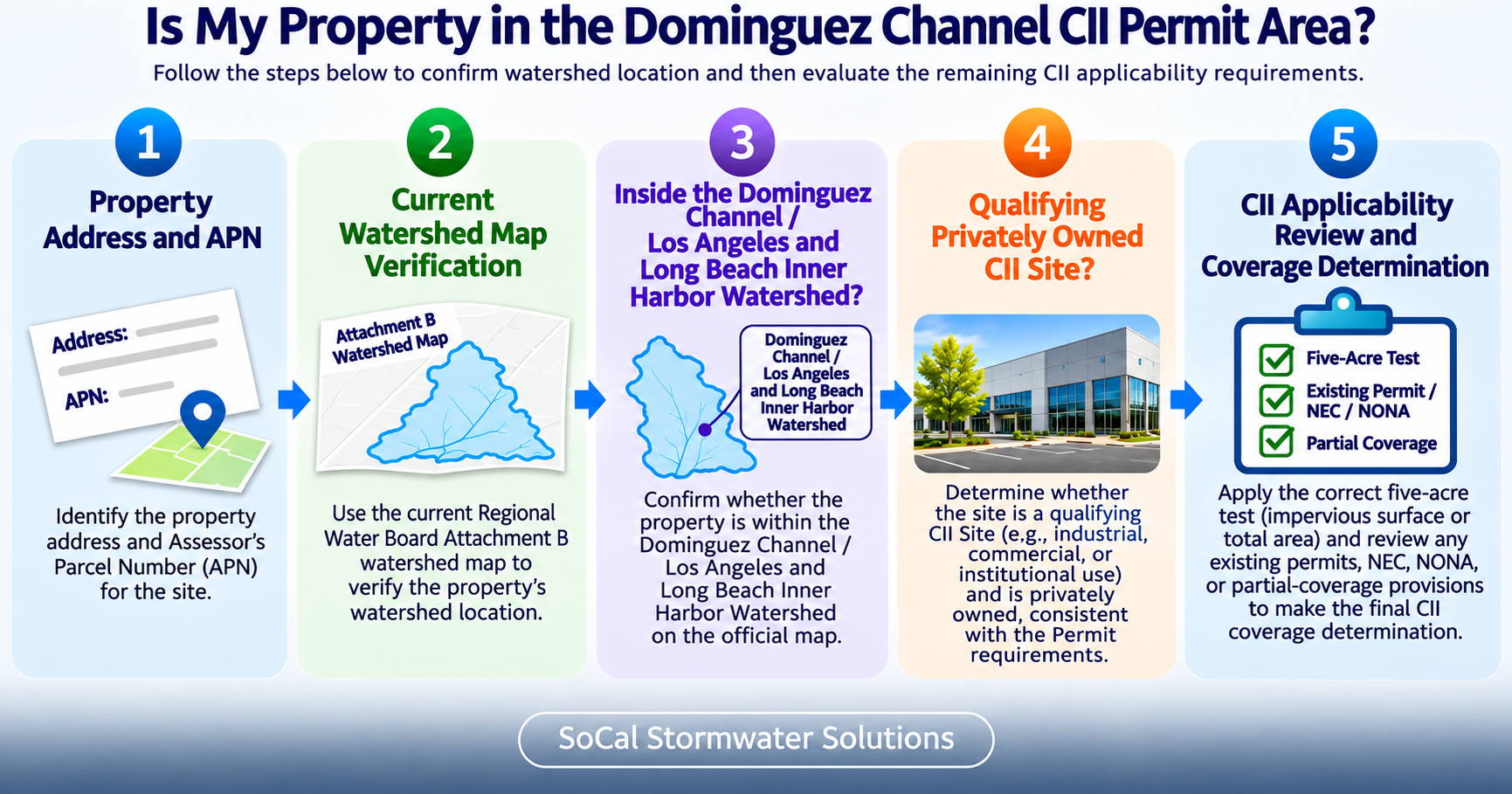
The legal coverage area follows the boundary of the Dominguez Channel / Los Angeles and Long Beach Inner Harbor Watershed named in the adopted Order. It does not follow city limits, ZIP-code boundaries, industrial districts, or the Los Angeles County boundary.
Parts of Carson, Long Beach, Los Angeles, and other communities may overlap the watershed. That does not mean every property in any named city is within the Permit area.
Local Example: Two Properties in the Same City
Consider two commercial properties within the same city. Official mapping may place one inside the covered watershed and the other outside it. Their shared city name, zoning designation, or mailing area does not produce the same geographic result.
This comparison demonstrates why location must be determined from the property and current watershed mapping rather than a citywide assumption.
A City Name Does Not Determine CII Permit Coverage
- Watershed boundaries do not follow municipal boundaries.
- A property in a city that overlaps the watershed may still be outside it.
- The parcel should be compared with current official watershed or designation mapping.
- Industrial zoning or proximity to the Dominguez Channel is not sufficient.
- The remaining applicability criteria are evaluated only after location is confirmed.
The Los Angeles Water Board CII Permit program page should be checked for current maps, permit documents, implementation materials, and announcements.
How do you confirm whether a property is inside the covered Watershed?
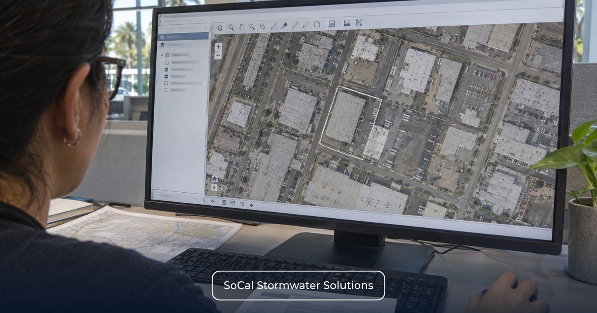
Begin with reliable property information and current official watershed or designation mapping. A general online map may help orient the reviewer, but it should not serve as the final evidence for a coverage determination.
Use:
- The complete property address;
- The Assessor Parcel Number or numbers;
- A current parcel or site map;
- Current Los Angeles Water Board or EPA watershed or designation mapping;
- Reliable property coordinates, when available; and
- Drainage information when the boundary or discharge pathway is unclear.
The APN identifies the property being reviewed but does not establish its watershed location. The parcel must be compared with the applicable official mapping.
Do not infer coverage from nearby roads, neighborhood names, channel names, mailing addresses, industrial zoning, or assumptions about where a storm drain flows.
If a parcel crosses a mapped watershed boundary, includes multiple APNs, or cannot be resolved clearly from available mapping, the appropriate next step is a documented technical review. An unclear map should not support a categorical coverage conclusion.
Why is the Dominguez Channel watershed subject to the CII permit?
On November 5, 2024, U.S. Environmental Protection Agency Region 9 finalized a residual designation for specified, previously unpermitted stormwater discharges from privately owned commercial, industrial, and institutional sites in two Los Angeles County watersheds.
The designation includes the Dominguez Channel and Los Angeles/Long Beach Inner Harbor watershed area and the Los Cerritos Channel/Alamitos Bay watershed. EPA used its residual designation authority under 40 CFR 122.26(a)(9)(i)(C) and (D) to require NPDES permitting for the designated sources. 3
EPA identifies elevated copper and zinc and the associated Total Maximum Daily Loads as important water-quality concerns in the two watersheds. This background explains the designation but does not mean copper and zinc are the only pollutants relevant to covered facilities.
The EPA designation also does not mean every CII property inside the watershed is covered. Current applicability is determined under the requirements of Order R4-2026-0226.
Which properties inside the Watershed may need CII coverage?
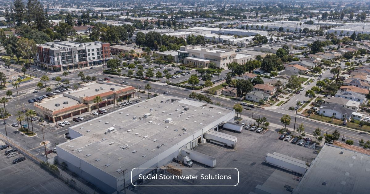
Once watershed location is confirmed, the property must be evaluated as a potential qualifying CII Site.
Attachment A defines a CII Site using private ownership, parcel configuration, and specified Los Angeles County Tax Assessor commercial, industrial, and institutional land-use classifications. A single APN should not automatically be treated as the final CII Site boundary when qualifying contiguous parcels may be involved.
Residential facilities are excluded. Mixed-use properties require application of Attachment A’s provisions for residential building footprints, common areas, shared parking, and qualifying commercial, industrial, or institutional portions.
After the CII Site boundary and existing NPDES status are established, apply the appropriate acreage branch.
Which 5-acre test applies in the Dominguez Channel Watershed?
The table identifies the acreage basis for each primary permit-status branch. It does not replace the site, ownership, watershed, and other applicability criteria.
| CII Permit Five-Acre Thresholds by Existing NPDES Coverage Status | ||
| Situation | Applicable Measurement | Primary Screening Question |
| Qualifying CII Site with No Other NPDES Stormwater Permit | Five or More Acres of Impervious Surface | How much impervious surface is within the qualifying CII Site? |
| Qualifying CII Site Covered by Another NPDES Stormwater Permit | Five or More Acres of Total Area | What is the full qualifying CII Site, and what does the existing permit cover? |
No Other NPDES Stormwater Permit
Section 3.1.2 uses five or more acres of impervious surface for a qualifying CII Site not covered by another NPDES stormwater permit. Total property area is not the measurement used in this branch.
Covered by Another NPDES Stormwater Permit
Section 3.1.3 uses five or more acres of total area for a qualifying CII Site covered by another NPDES stormwater permit. The existing permit’s actual scope must also be verified.
Detailed measurement guidance is provided in Region 4 CII Permit 5-Acre Threshold: Does Your Property Need Coverage?.
What if the site has an existing permit or multi-parcel conditions?
Existing NPDES stormwater coverage does not automatically resolve CII applicability. Industrial General Permit coverage, a No Exposure Certification (NEC), and a Notice of Non-Applicability (NONA) have different regulatory effects and must be evaluated under the corresponding provisions of Order R4-2026-0226. An NEC is not a separate NPDES permit, and a NONA does not independently establish an exemption from every CII requirement.
The Industrial Stormwater Permitting Process provides additional context for reviewing an existing WDID, Industrial General Permit status, and permit pathway.
California’s Industrial General Permit expired on June 30, 2020, but remains administratively continued under 40 CFR 122.6 until a replacement permit is issued. 4
The relevant CII provisions can be summarized as follows:
- Existing NPDES or IGP coverage: Section 3.1.3 may apply using five or more acres of total area. Review Existing NPDES or IGP Coverage? When the Region 4 CII Permit Still Applies for the permit-boundary analysis.
- NEC: Section 3.1.3.1 addresses acreage covered by a No Exposure Certification when the remaining CII applicability criteria are met.
- NONA: Section 3.1.3.2 addresses acreage not covered by the NONA. See How the CII Permit Applies to NONA Facilities.
- Partial NPDES coverage: Section 3.1.3.3 addresses the remaining portion of a qualifying facility. See CII Permit Rules for Partially Covered Properties.
- Individual NPDES permit: Section 3.1.4 removes the need for separate CII coverage only when the individual permit contains requirements at least as stringent as the CII Permit.
Parcel configuration may also affect the analysis. A CII Site may include contiguous qualifying parcels, while campus and common-development provisions separately address how qualifying parcels may obtain permit coverage.
Nearby or commonly owned parcels should not be combined merely because they are within the same watershed. Full parcel and permit-structure analysis belongs in CII Permit Coverage for Contiguous Parcels and Campuses.
What should a Dominguez Channel property owner review before CII enrollment?
Complete the watershed and applicability review before beginning SMARTS registration or assuming that a site-specific SWPPP is required.
Dominguez Channel CII Screening Checklist
Gather:
- Property address and APNs;
- Current watershed-location verification;
- Parcel and site maps;
- Assessor land-use classification;
- Private ownership and operator information;
- Residential or mixed-use components;
- Total site acreage;
- Impervious acreage;
- Current NPDES or Industrial General Permit status and WDID;
- NEC or NONA records;
- Current SWPPP and site map, if applicable;
- Drainage areas and discharge points;
- Contiguous-parcel or campus configuration; and
- Any individual NPDES permit.
Existing maps and permit records may not reflect current drainage areas, discharge points, or site operations. Where field confirmation is needed, Industrial Inspections and Monitoring provides information about related services. Any CII-specific scope should be confirmed during the initial review.
After applicability is established, SMARTS Permitting and Application Services may support applicable registration and reporting workflows. Industrial SWPPP Services may remain relevant where the property also has Industrial General Permit obligations.
Request a CII Permit Applicability Screening
Not sure whether your property falls within the Dominguez Channel CII Permit area? SoCal Stormwater Solutions can review your property’s watershed location, land-use classification, acreage, existing permit status, and parcel configuration to help assess potential coverage requirements.
Request a CII Permit Applicability Screening to discuss the information needed for your property-specific review.
Screening is based on available property and permit records. It does not guarantee a particular determination by the Los Angeles Water Board.