Los Cerritos Channel flows through a heavily developed part of southeastern Los Angeles County, but its name is not a reliable indicator of which properties fall within the Region 4 CII Stormwater Permit area. The relevant geographic boundary is the designated Los Cerritos Channel / Alamitos Bay Watershed.
Determining whether a particular facility requires coverage involves matching its location and drainage information to that watershed, then assessing the qualifying CII Site, ownership, acreage, and existing NPDES permit conditions under Order R4-2026-0226.
Order R4-2026-0226 / NPDES Permit CAS004005 became effective on October 31, 2026, and is listed as active by the Los Angeles Regional Water Quality Control Board. 1

TL;DR
- Los Cerritos Channel is part of the Los Cerritos Channel / Alamitos Bay Watershed covered by Order R4-2026-0226. It is not regulated under a separate channel permit.
- The Order’s Fact Sheet describes Los Cerritos Channel as draining an approximately 37-square-mile, densely urbanized watershed to Alamitos Bay.
- A city name, ZIP code, or proximity to the channel does not establish watershed location or Permit coverage.
- Property screening should use Attachment B Figure B-1, Attachment C Figure C-1 where necessary, and available site-drainage information.
- After location is confirmed, the separate CII Site, ownership, acreage, existing-NPDES, and special-status requirements must be applied.
Does the Region 4 CII permit apply in the Los Cerritos Channel watershed?
Los Cerritos Channel falls within one of the two watershed systems identified in Order R4-2026-0226. Coverage is determined for qualifying facilities within the Los Cerritos Channel / Alamitos Bay Watershed, rather than for the channel corridor as a separate regulatory area.
The adopted Order regulates qualifying stormwater and authorized non-stormwater discharges from certain privately owned commercial, industrial, and institutional sites in two watershed systems:
- The Dominguez Channel / Los Angeles and Long Beach Inner Harbor Watershed; and
- The Los Cerritos Channel / Alamitos Bay Watershed. 2
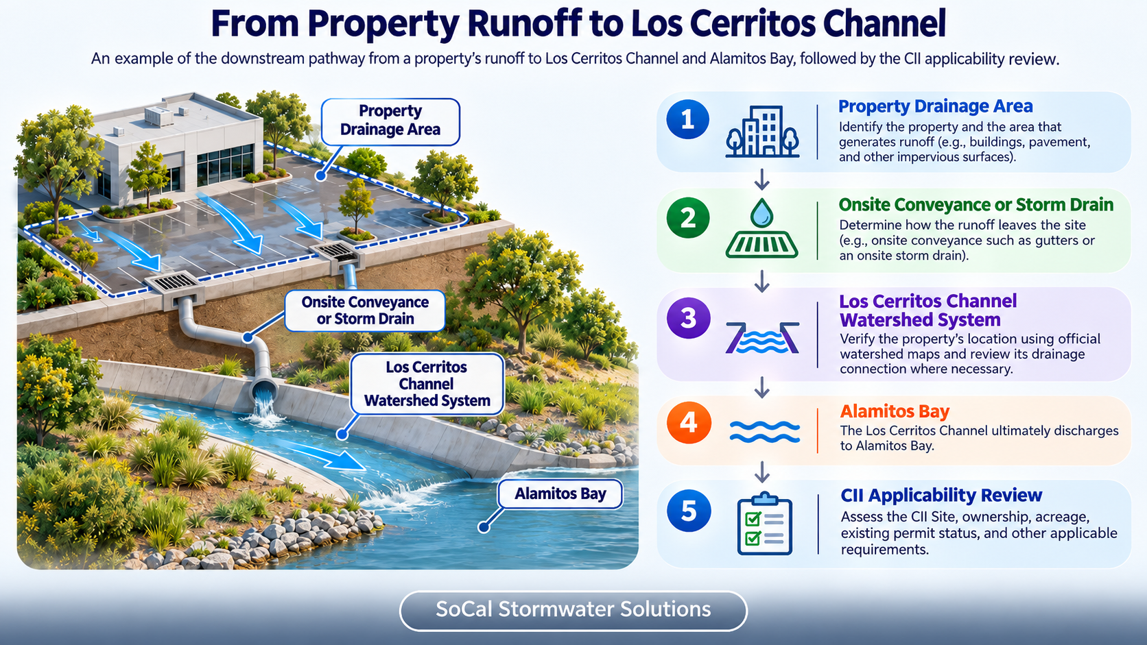
For a Los Cerritos Channel screening, first verify whether the property falls within the adopted Los Cerritos Channel / Alamitos Bay Watershed. Where drainage pathways require clarification, determine whether runoff enters Los Cerritos Channel or another receiving-water route within the same watershed. Discharges may travel through onsite drainage, an MS4, another public storm drain, or a private conveyance before reaching receiving waters.
Geographic confirmation is only the first gate. The property must also meet the Permit’s CII Site, private-ownership, acreage, existing-permit, and other applicable provisions.
For the complete geographic framework covering both watershed systems, see Where Does the Region 4 CII Stormwater Permit Apply?
How does Los Cerritos Channel connect to Alamitos Bay?
Los Cerritos Channel carries runoff through an urbanized drainage system toward Alamitos Bay. The channel and bay are regulated within the combined Los Cerritos Channel / Alamitos Bay Watershed framework rather than as separate CII Permit areas.
The Permit’s Fact Sheet describes the watershed as covering approximately 37 square miles, or 23,680 acres, and draining to Alamitos Bay. It also states that the Los Cerritos Channel tidal prism begins at Anaheim Road and connects with Alamitos Bay through Marine Stadium.2
The reference to Anaheim Road describes the tidal portion of the channel; it should not be interpreted as a geographic cutoff for determining whether an individual property requires CII coverage.
The relevant terms should remain distinct:
- Los Cerritos Channel / Alamitos Bay Watershed is the adopted geographic coverage framework.
- Los Cerritos Channel is the upstream channel and drainage-path component.
- Alamitos Bay is the downstream receiving-water component.
- A tidal prism describes the water exchanged within a tidal system.
- A CII Site is evaluated separately under the Permit’s site and applicability definitions.
EPA’s residual designation provides the federal background for NPDES regulation of specified privately owned CII stormwater discharges in the two designated Los Angeles County watershed areas. 3
For a more focused discussion of the downstream receiving-water component, see Alamitos Bay CII Stormwater Permit Guide.
How do you check whether a property drains to Los Cerritos Channel?
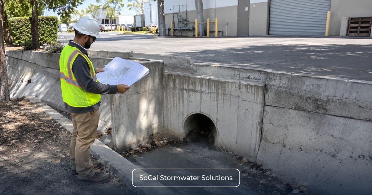
Begin with the property and follow its drainage route toward the receiving-water system. A city map or the visible location of the channel is not sufficient.
Use the following sequence:
- Establish the property boundary. Record the street address, Assessor Parcel Numbers (APNs), site limits, and any potentially relevant contiguous parcels.
- Locate the site on Figure B-1. Attachment B shows the mapped hydrologic units associated with the Los Cerritos Channel / Alamitos Bay Watershed Management Area.
- Examine the regional drainage network. Where the discharge route is uncertain, Attachment C Figure C-1 provides additional storm-drain-system context.
- Account for onsite drainage features. Roof drains, paved surfaces, catch basins, pipes, open channels, and surface grades can help explain how runoff leaves the facility.
- Follow the receiving-water connection. Determine whether the available evidence supports drainage toward Los Cerritos Channel, Alamitos Bay, or another receiving-water route within the designated watershed.
- Resolve gaps in the evidence. Facility drawings, utility records, field observations, or agency clarification may be needed before reaching a geographic conclusion.
- Complete the regulatory assessment. Once the watershed relationship is established, examine the site’s classification, ownership, acreage, existing permit coverage, and applicable special provisions.
Attachment B provides the watershed framework, while Attachment C supplies regional storm-drain-system context. A storm-drain line appearing on a regional map does not, by itself, establish an individual facility’s discharge route.
For the detailed property-level review process, see How to Determine Which Watershed Your Property Drains to.
Are all properties in nearby cities covered?
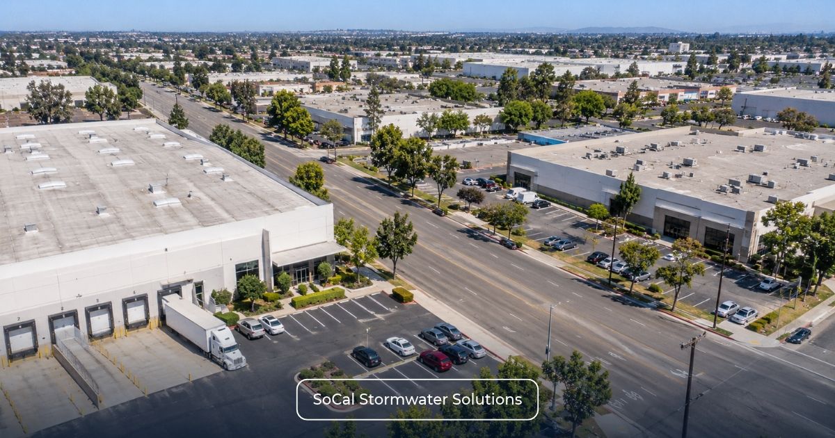
No. Watershed boundaries do not follow municipal boundaries, and Order R4-2026-0226 does not establish citywide CII coverage for Cerritos, Long Beach, Lakewood, Signal Hill, Paramount, Bellflower, Downey, or other nearby communities.
Parts of one city may lie within different drainage areas. Even where Los Cerritos Channel passes through or near a community, individual properties still require official map verification and, where necessary, a review of site drainage.
For example, two facilities in the same city may connect to different storm-drain networks. One may drain toward Los Cerritos Channel, while the other may reach a different receiving-water system. Their shared city name and similar land use do not establish the same geographic result.
What does not prove Los Cerritos Channel coverage?
The following information can help identify a property but cannot establish coverage by itself:
- A city or community name;
- A ZIP code;
- Proximity to Los Cerritos Channel;
- Proximity to Alamitos Bay;
- A storm drain beside the property;
- A general municipal drainage map without property-level review; or
- A mailing address associated with the channel or bay area.
The conclusion should rely on the official watershed framework and sufficiently supported property and drainage information.
For comparison with the other adopted watershed system, see Los Angeles & Long Beach Inner Harbor CII Permit Guide and Dominguez Channel CII Stormwater Permit Guide.
Which properties inside the watershed may need CII coverage?
A confirmed watershed location establishes the geographic context, but the coverage assessment also depends on how the facility is classified and how its qualifying site boundary is defined.
Under Attachment A, the CII Site definition incorporates specified Los Angeles County Tax Assessor land-use classifications and parcel configurations. Residential and mixed-use conditions may affect which areas are evaluated. The applicable acreage test then depends on the site’s existing NPDES stormwater permit status, with separate provisions addressing NECs, NONAs, partially covered facilities, and qualifying individual permits.
These requirements are applied to the property under review; they are not determined by the presence of Los Cerritos Channel within the surrounding drainage system.
Which five-acre test applies?
The correct acreage test depends on whether another NPDES stormwater permit covers the qualifying CII Site. The table summarizes the two principal branches without replacing the complete applicability review.
| CII permit acreage thresholds by existing NPDES coverage status | ||
| Property Status | Principal Acreage Test | Required Follow-Up Review |
| CII Site Not Covered by Another NPDES Stormwater Permit | Five or More Acres of Impervious Surface | Confirm the CII Site boundary, qualifying use, private ownership, watershed location, and applicable exclusions. |
| Certain CII Sites Covered by Another NPDES Stormwater Permit | Five or More Acres of Total Area | Identify the permitted acreage and evaluate NEC, NONA, partial coverage, and other applicable provisions. |
An Assessor Parcel Number does not necessarily define the complete CII Site. Qualifying contiguous parcels may form a CII Site under Attachment A, while campus and common-development provisions separately address how qualifying parcels may obtain permit coverage. Nearby location or common ownership alone does not automatically combine parcels into one CII Site.
For the complete acreage methodology, see Region 4 CII Permit 5-Acre Threshold: Does Your Property Need Coverage?.
What if the property already has another NPDES permit?
Existing stormwater-permit coverage does not automatically exempt the full property or determine which CII acreage provisions apply. The facility should compare the complete qualifying CII Site with the documented scope of its current permit. Existing NPDES or IGP Coverage? When the Region 4 CII Permit Still Applies explains this permit-boundary review.
Facilities with Industrial General Permit coverage, a No Exposure Certification, or a Notice of Non-Applicability require status-specific analysis. Already Have IGP Coverage, an NEC, or a NONA? How the Region 4 CII Permit Applies explains the main differences among those records.
The Order separately addresses acreage associated with an NEC, acreage not covered by a NONA, and portions of qualifying facilities not covered by another NPDES stormwater permit. Where one of those conditions controls the analysis, use the dedicated guidance on how the CII Permit applies to NONA facilities or the CII Permit rules for partially covered properties.
An individual NPDES permit provides an exception only when its requirements are at least as stringent as the CII General Permit. The existence of an individual permit alone does not establish that condition.2
The Industrial Stormwater Permitting Process provides additional context for reviewing existing industrial stormwater obligations. Watershed location and CII applicability should be established before enrollment work begins.
What should you gather for a Los Cerritos Channel CII screening?
A useful screening combines official mapping with the property, drainage, ownership, acreage, and permit information needed to evaluate the watershed question and subsequent coverage requirements.
Los Cerritos Channel screening information
Gather:
- Property address and APNs;
- Parcel or site map;
- Facility boundary and relevant contiguous parcels;
- Current site drainage map, if available;
- Drainage areas and surface-flow directions;
- Catch basins, roof drains, channels, pipes, and discharge points;
- Known public or private storm-drain connections and outfall information;
- Facility use and land-use classification;
- Property owner and operator information;
- Residential or mixed-use components;
- Total and impervious acreage;
- Existing WDID and NPDES permit information;
- NEC or NONA records, where applicable;
- Boundaries of partially permitted portions; and
- Information about campus operations or shared drainage.
If screening establishes that CII coverage is required, SMARTS Permitting and Application Services may support the applicable electronic enrollment process.
Request a Los Cerritos Channel CII Applicability Screening
Unsure whether your property falls within the Los Cerritos Channel / Alamitos Bay CII Permit area? SoCal Stormwater Solutions can review official watershed maps, site drainage, property classification, acreage, and existing permit status to help assess potential coverage requirements.
Request a CII Permit Applicability Screening to discuss the information needed for your property-specific review.
Screening is based on available property and permit information and does not guarantee a particular determination by the Los Angeles Water Board.