Alamitos Bay is the downstream receiving water of an urban watershed that extends well beyond the shoreline. For properties being evaluated under the Region 4 Commercial, Industrial, and Institutional Stormwater Permit, the relevant geographic area is the Los Cerritos Channel / Alamitos Bay Watershed—not simply the land surrounding the bay.
A coverage assessment begins with the property’s position within that designated watershed, supported by drainage records where needed. The findings must then be considered alongside the Order’s CII Site definition, private-ownership requirements, acreage thresholds, existing NPDES stormwater coverage, and applicable exceptions.
Order R4-2026-0226 / NPDES Permit CAS004005 became effective on October 31, 2026, and is listed as active by the Los Angeles Regional Water Quality Control Board. 1

TL;DR
- Alamitos Bay is the downstream receiving-water component of the Los Cerritos Channel / Alamitos Bay Watershed covered by Order R4-2026-0226.
- There is no separate Alamitos Bay CII permit.
- The Permit is not limited to shoreline properties. An upstream property can be within the covered watershed without having direct bay frontage.
- Attachment B Figure B-1, Attachment C Figure C-1 where needed, and site-drainage information provide the starting point for geographic screening.
- Being within the watershed does not by itself establish CII Permit coverage.
- Facility classification, ownership, acreage, existing NPDES coverage, and special permit conditions must be reviewed separately.
Does the Region 4 CII permit apply to properties draining to Alamitos Bay?
Yes, potentially. Alamitos Bay belongs to one of the two watershed systems covered by Order R4-2026-0226. The Permit addresses qualifying stormwater and authorized non-stormwater discharges from certain privately owned commercial, industrial, and institutional sites within:
- The Dominguez Channel / Los Angeles and Long Beach Inner Harbor Watershed; and
- The Los Cerritos Channel / Alamitos Bay Watershed. 2
The relevant geographic question is not how many miles separate a property from the bay. The review must establish whether the property lies within the combined watershed and whether available drainage information is consistent with that location.
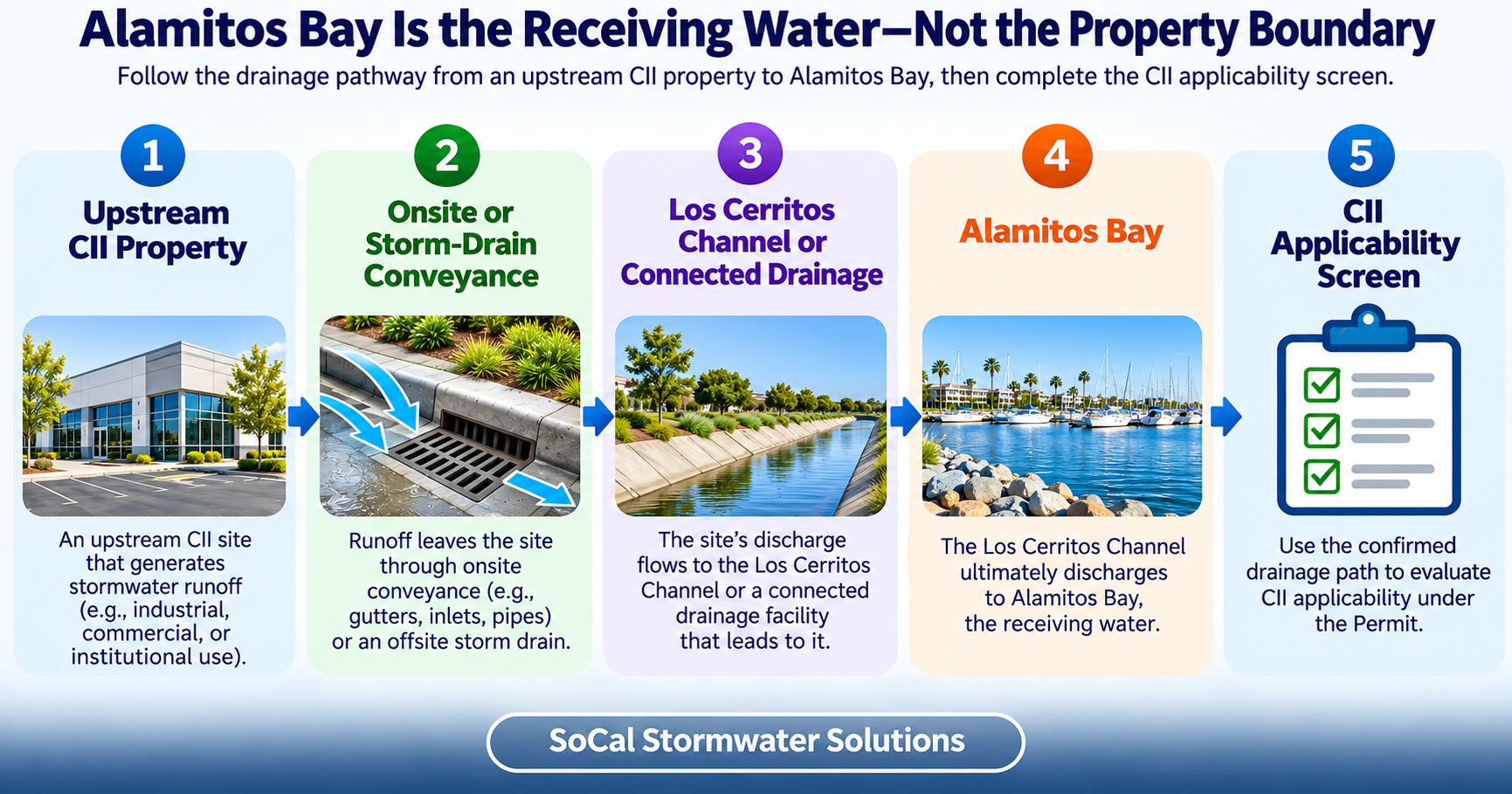
A facility does not need a private outfall discharging directly into Alamitos Bay. Runoff can travel through catch basins, underground pipes, public storm drains, channels, or private conveyances before reaching connected receiving waters.
For the complete geographic framework covering both adopted watershed systems, see Where Does the Region 4 CII Stormwater Permit Apply?
How does Alamitos Bay fit into the Los Cerritos Channel watershed?
The name of the designated watershed reflects two connected features: Los Cerritos Channel, which conveys runoff through the drainage system, and Alamitos Bay, which receives water downstream. The geographic area relevant to the CII Permit extends across the watershed rather than stopping at the bay’s shoreline.
For property-level screening, the following distinctions matter:
- The watershed identifies the relevant land and drainage area.
- Alamitos Bay is a receiving water within that watershed.
- A storm drain or private conveyance transports runoff but does not independently define the watershed boundary.
- A CII Site is determined under the Order’s property, land-use, ownership, and parcel provisions.
The Permit’s Fact Sheet describes Los Cerritos Channel as draining an approximately 37-square-mile urbanized watershed to Alamitos Bay. It describes Alamitos Bay as including Marine Stadium, Long Beach Marina, public and private berths, and the bay proper. Colorado Lagoon is identified as having a tidal connection with the bay.2
These water features explain the connected receiving-water setting. They do not create separate CII boundaries. A property near Colorado Lagoon, Marine Stadium, or Long Beach Marina still requires a watershed and site-level applicability review.
The Fact Sheet also identifies indicator bacteria and dissolved oxygen in its discussion of Alamitos Bay’s 2018 Clean Water Act section 303(d) listing. That impairment context helps explain the regulatory setting but is not a separate test for deciding whether an individual property requires coverage.
EPA’s residual designation supplies the federal background for NPDES regulation of specified CII stormwater discharges in the two designated watershed areas.3
Detailed upstream channel hydrology and routing belong in the Los Cerritos Channel CII Stormwater Permit Guide.
Do only waterfront properties need to check CII coverage?
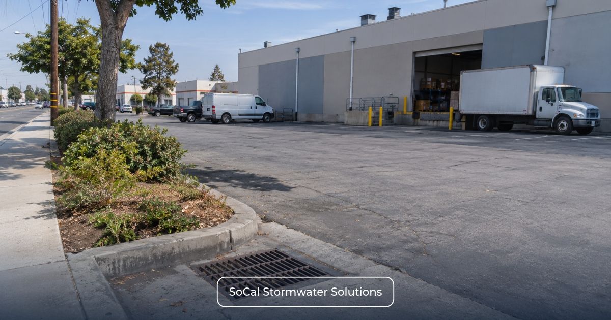
Shoreline access is not a condition for CII Permit applicability. An inland commercial facility, for example, may collect runoff from rooftops and paved areas through onsite catch basins before conveying it into a public storm-drain network. Its relationship to the Los Cerritos Channel / Alamitos Bay Watershed must be established through mapping and supporting drainage information, regardless of whether the bay is visible from the property.
The same geographic assessment applies to waterfront facilities. A marina address may provide useful location information, but it cannot establish whether a particular CII Site satisfies the Order’s watershed and other applicability requirements.
What does not establish Alamitos Bay CII coverage?
None of the following provides a complete coverage determination:
- A shoreline or marina-area address;
- A stated distance from Alamitos Bay;
- A view of the bay or another connected waterbody;
- An east Long Beach, Signal Hill, Lakewood, or nearby community address;
- Proximity to Colorado Lagoon or Marine Stadium;
- A storm-drain inlet beside the property; or
- A general assumption that all nearby runoff reaches Alamitos Bay.
Municipal boundaries and watershed boundaries answer different questions. No citywide coverage conclusion should be drawn from this guide.
For the receiving-water counterpart within the other adopted watershed system, see Los Angeles & Long Beach Inner Harbor CII Permit Guide.
How do you verify whether a property drains to Alamitos Bay?
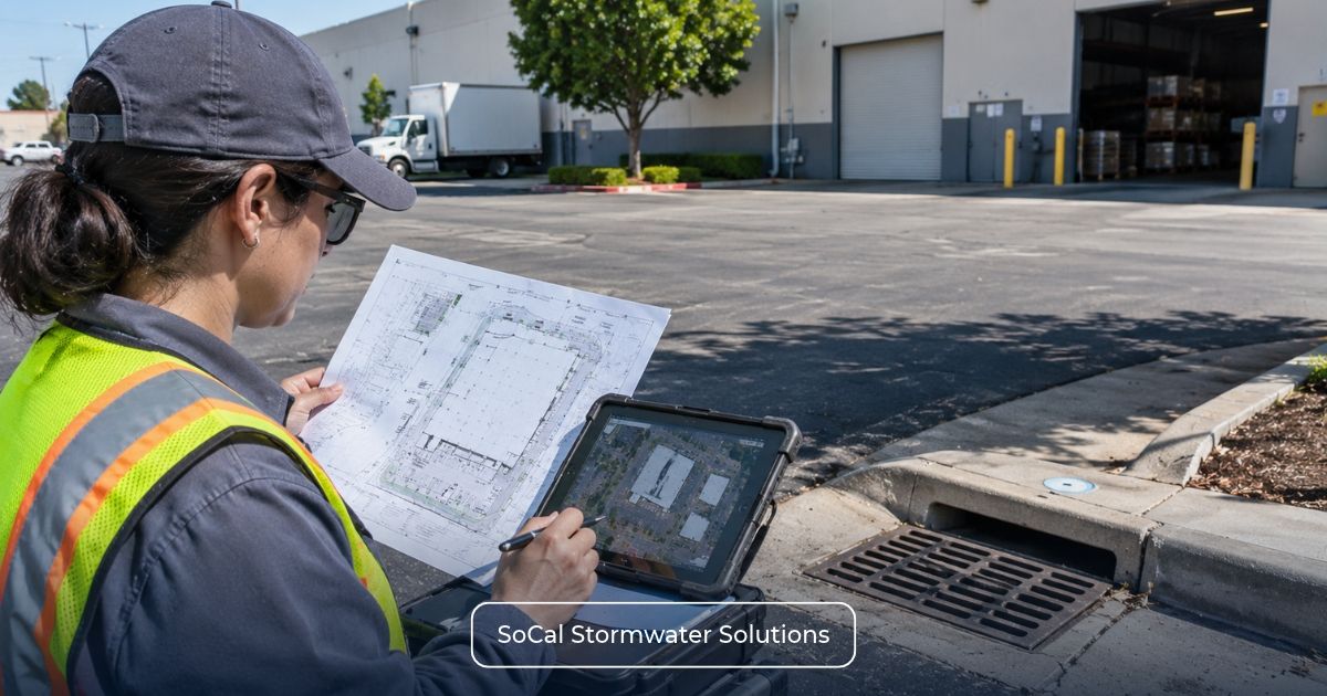
A defensible geographic review combines several types of evidence rather than relying on one map or one visible drainage feature.
1. Property boundary evidence
Confirm the street address, APNs, parcel boundaries, facility limits, and any contiguous parcels associated with the operation.
2. Watershed evidence
Use Attachment B Figure B-1 to locate the property within the Los Cerritos Channel and Alamitos Bay Watershed Management Area hydrologic units.
3. Conveyance evidence
Where the drainage route is not apparent, review Attachment C Figure C-1 together with roof drains, catch basins, pipes, channels, surface-flow directions, and known public or private storm-drain connections.
4. Receiving-water evidence
Evaluate whether the mapped and documented pathway places the property within the connected system that reaches Los Cerritos Channel or Alamitos Bay. A regional storm-drain line alone does not prove the route from a specific facility.
5. Applicability evidence
Once geography is reasonably established, document CII Site classification, ownership, acreage, existing permit status, and any NEC, NONA, partial-coverage, or individual-permit condition.
Modified drainage, multiple discharge points, incomplete maps, or conflicting records may require field observations, facility plans, utility information, or agency clarification.
For the complete property-level methodology, see How to Determine Which Watershed Your Property Drains to.
Which properties within the watershed may need coverage?
Geographic confirmation moves the property into the applicability review; it does not complete that review. The next questions concern the regulatory status of the property itself.
The reviewer should establish:
- Whether the relevant property meets the CII Site definition;
- Whether the site is privately owned;
- Whether residential or mixed-use conditions change the qualifying boundary;
- Which five-acre branch applies;
- Whether another NPDES stormwater permit covers any part of the site; and
- Whether special permit or parcel provisions affect the result.
Which five-acre test applies?
Sections 3.1.2 and 3.1.3 establish different five-acre measurements according to the qualifying site’s existing NPDES stormwater coverage.
| CII permit five-acre thresholds and required applicability reviews | ||
| Property Status | Principal Acreage Test | Additional Review Needed |
| CII Site Not Covered by Another NPDES Stormwater Permit | Five or More Acres of Impervious Surface | Confirm the CII Site boundary, private ownership, qualifying use, watershed location, and applicable exclusions. |
| Certain CII Sites Covered by Another NPDES Stormwater Permit | Five or More Acres of Total Area | Determine the covered acreage and evaluate NEC, NONA, partial coverage, and other applicable provisions. |
A CII Site may encompass qualifying contiguous parcels rather than a single APN. Attachment A governs that site definition, while its campus and common-development provisions address distinct coverage arrangements. Existing drainage and permit records help establish the relevant conditions but do not, by themselves, combine separate parcels into one CII Site.
For detailed acreage methodology, see Region 4 CII Permit 5-Acre Threshold: Does Your Property Need Coverage?.
What if the property already has another NPDES permit?
Existing NPDES stormwater coverage can change the acreage branch and determine which property portions require further review. It does not automatically settle CII applicability.
Begin by comparing the complete qualifying CII Site with the documented boundary of the existing permit. Existing NPDES or IGP Coverage? When the Region 4 CII Permit Still Applies explains the broader permit-boundary analysis.
NEC, NONA, and partial-coverage conditions have different effects. The Order addresses acreage covered by an NEC, acreage not covered by a NONA, and the remaining portion when another NPDES stormwater permit covers only part of a qualifying facility. These status differences are summarized in Already Have IGP Coverage, an NEC, or a NONA? How the Region 4 CII Permit Applies.
An individual NPDES permit removes the need for separate CII coverage only when it contains requirements at least as stringent as the CII Permit. 2
The Industrial Stormwater Permitting Process provides additional context for reviewing a current WDID or industrial stormwater status. Registration work should begin only after watershed connection and site-level applicability are established.
What should you gather for an Alamitos Bay CII screening?
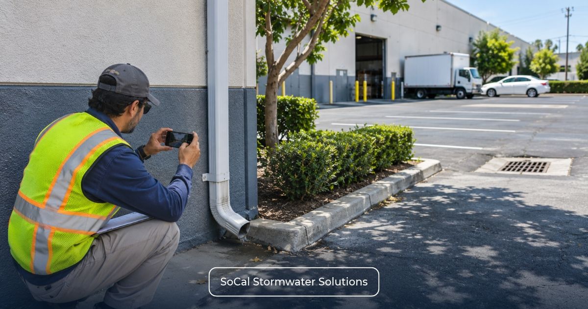
For an Alamitos Bay property review, the records should show more than the facility’s address. Drainage plans and receiving-water information help establish its relationship to the watershed, while land-use, ownership, acreage, and permit documents support the subsequent regulatory assessment.
Alamitos Bay CII screening information
Gather:
- Property address and APNs;
- Parcel, site, and operational boundaries;
- Current drainage map, if available;
- Drainage areas and surface-flow directions;
- Roof drains, catch basins, pipes, channels, and discharge points;
- Known public or private storm-drain connections;
- Known outfall or receiving-water information;
- Facility use and land-use classification;
- Property owner and operator information;
- Residential or mixed-use components;
- Total and impervious acreage;
- Existing WDID and NPDES permit records;
- NEC, NONA, or partial-coverage documentation; and
- Contiguous-parcel or campus information.
If the screening indicates that CII coverage is required, SMARTS Permitting and Application Services may support the applicable electronic enrollment process.
Request an Alamitos Bay CII applicability screening
Unsure whether your property falls within the Los Cerritos Channel / Alamitos Bay Watershed? SoCal Stormwater Solutions can review official watershed maps, drainage information, site classification, acreage, and existing permit status to help assess potential CII coverage requirements.
Request a CII Permit Applicability Screening to discuss the information needed for your property-specific review.